
Camillus Neighbors by Parcel
Records about the immediate Camillus block are best read as geography, ownership history, and dated context. A map can identify the parcels touching a chosen lot. The assessment record can identify the assessed owner and tax fields for one parcel. A deed index documents a transfer, not every current resident. Local directories and census material can show a past household, but only for their stated year. Those distinctions keep the work focused on the block without creating a current roster.
| Source | What It Shows About a Block | Access |
|---|---|---|
| Onondaga GIS viewer | Selected parcel, adjacent geometry, road labels, map layers, measurements, and a dated PDF export | Public web viewer; layer visibility can depend on zoom and the map is informational |
| RPTS / Beacon | Owner, assessment, tax-map, situs, mailing, and SBL fields for each parcel searched | Public search; enter one item and narrow; records are not guaranteed complete or current |
| County deed index | Transfers, grantor and grantee, recording date, book or page, and legal description | Guest index; images need an account, subscription, or County Clerk counter route |
| NYS voter lookup | An individual voter’s own registration and poll-site response | Individual lookup only; it is not a browsable block list |
| OCPL directories and census | Dated occupants, households, road, post-office, or lot clues | Library holdings, query service, and licensed resources; annual gaps occur |
The owner field and a mailing field do not identify every person who lives at a location. A trust, estate, corporation, or owner outside Camillus may appear in the assessment record. Treat a parcel map, legal description, and a dated historical source as separate pieces of evidence with separate dates.
Camillus Neighbors GIS Flow
Use Onondaga GIS On the Web to move from one address to its immediate surroundings. The viewer supports address or parcel searching, selecting a parcel, available layers, geometry or measure tools, and PDF export. Its lines and measurements help orient a research note, but they are not a legal survey. The tax map and deed record carry the property-record authority that the map itself does not provide.
- Locate the address with the viewer’s address finder or search controls, then select the parcel feature.
- Zoom until surrounding parcel polygons and road labels are visible. Record the map date, visible layers, and the selected parcel identifier.
- Note the adjoining SBLs. An SBL is the local tax-map identifier for a parcel, not a household identifier.
- Search Onondaga RPTS / Beacon separately for each selected SBL or address. Retain the assessment-roll year with each result.
- Search the County Clerk index by the documented owner or prior transfer party, then use the deed’s legal description to confirm it belongs to that parcel.
- For a broader road-by-road chain, use the Camillus street directory rather than extending an adjacent-parcel view into a whole-street roster.
The county GIS viewer is the starting point for the selected-parcel workflow.
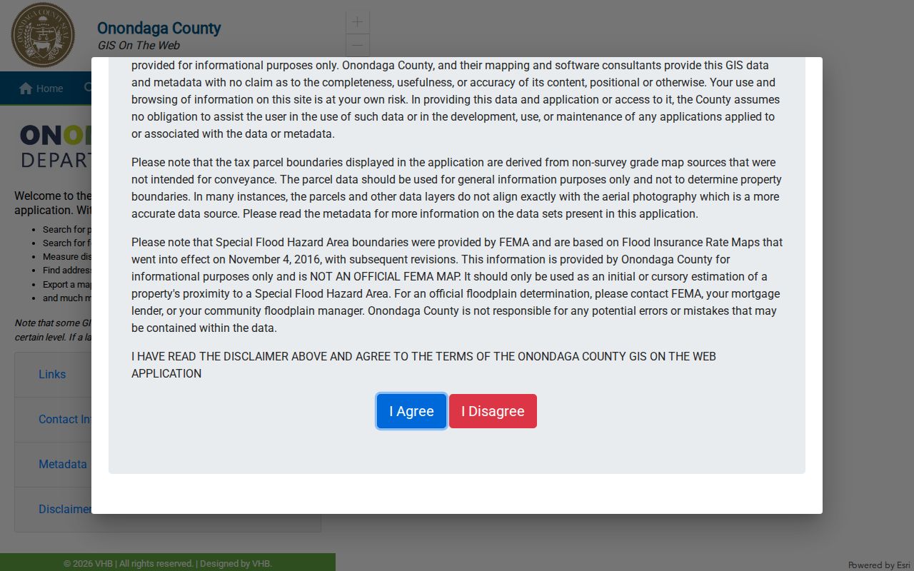
Repeat the official assessment search one parcel at a time. If Beacon is unavailable, the county RPTS page and legacy Image Mate route are the documented fallbacks, not an unofficial copy of the data.
Camillus Neighbor Tax Records
Assessment and tax fields answer a limited set of block questions. The owner field identifies the assessed owner or entity. The situs field identifies the parcel’s physical location. The mailing field identifies where assessment correspondence is sent. Assessed value and exemptions belong to the tax context. None alone establishes who occupies a home, and a mailing address should never be recast as a confirmed resident address.
The county says its assessment data comes from town assessors and may change before the final roll. Capture the roll year and retrieval date. Entering one search item before narrowing reduces false matches, especially where a road name or owner name repeats. A parcel can also be split or consolidated, so older deeds may use a lot, block, metes-and-bounds, or map reference that does not match the current SBL.
Note: The public map is useful for orientation, while the assessment portal and a deed’s legal description are the records to retain when the parcel identity matters.
Camillus Neighbors and Deeds
The Onondaga County Clerk’s Cott eSearch provides a free guest index for recorded land instruments. Search a documented owner or transfer party, then compare the recording date, book or page, and legal description with the parcel. The underlying image can be necessary to understand the tract and clauses. Images are not available for every index entry and may require an account, subscription, or a copy request at the County Clerk.
Deeds are a historical layer, not a way to identify all Camillus neighbors now. Follow a prior grantor only when the legal description or a parcel reference supports the connection. Estate, spouse, trust, and corporate names can explain why a direct surname trail stops. Onondaga land records date to 1794, which makes the clerk’s books useful when local town records are missing.
For the immediate block, stop once the selected parcels have been checked. A chain for an entire named street has a different purpose and needs the street-level sources and continuity checks described on the linked street directory.
Camillus Neighbor Contact Sources
No comprehensive, official Camillus neighborhood-association roster or umbrella directory was found in the research. That absence matters. Do not infer that a parcel owner belongs to an association, congregation, civic group, or block-watch program. The verified alternatives below are starting points for public community information and local-history questions, not member lists.
| Town community and government hub | Official starting point for town departments and public community links; no dedicated association directory was identified there. |
|---|---|
| OCPL Local History & Genealogy | Directories, maps, census microfilm, newspapers, obituary material, and local-history leads for a stated period. |
| Camillus Historical Society | Family-history and photo databases, maps, and appointment or Tuesday-hour research access. |
| Onondaga Historical Association | Family files, photographs, maps, and county documents; confirm current access because its Research Center has had construction-related service limits. |
The Town’s community-government page is the documented official route for public local links.
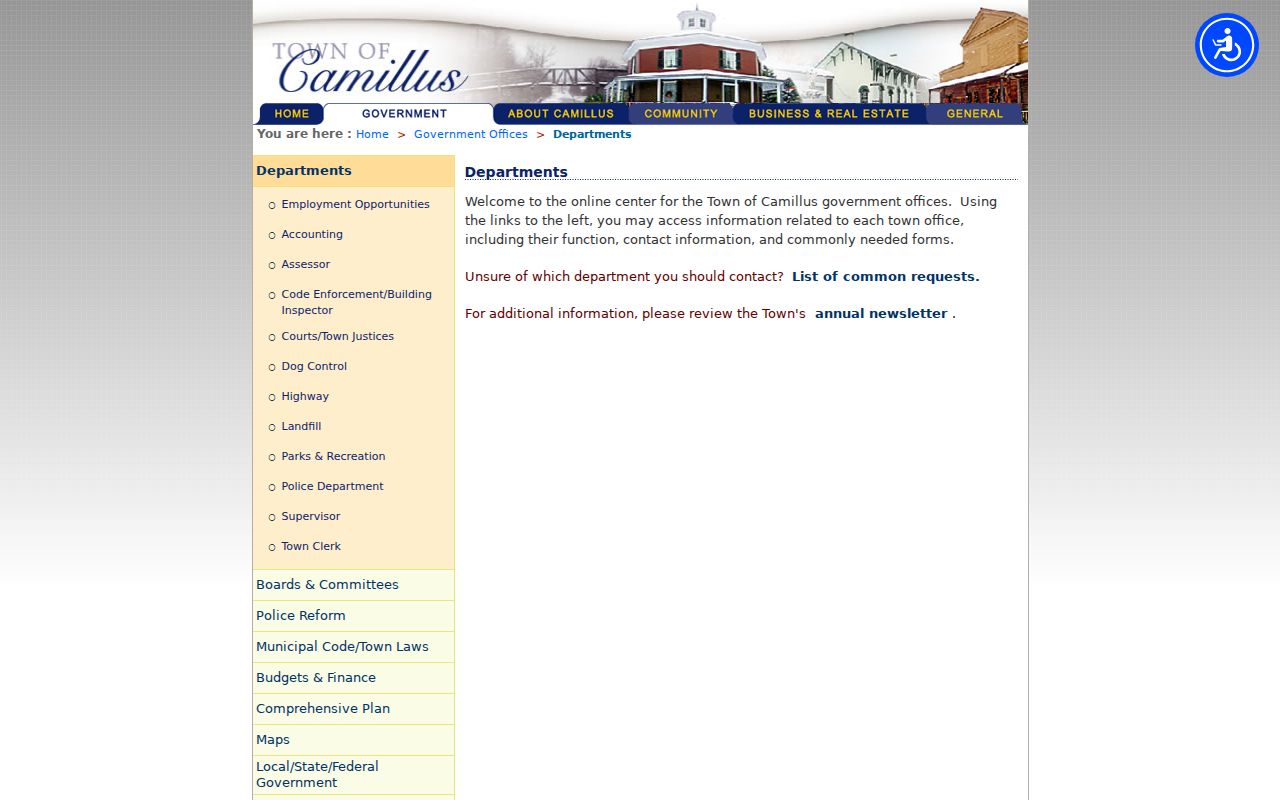
For a historical block question, ask a library or archive about the target year, road, post office, or map title. A current organization should be used only when it publishes its own public contact route.
Camillus Neighbors Voter Limits
New York’s voter lookup is a personal registration and poll-site tool. It asks for county, last name, first name, date of birth, ZIP code, and address information. It does not offer a public control to display every voter on a Camillus street or in a block. The correct path for a voter is to check their own registration or contact the Onondaga County Board of Elections about a personal registration question.
Election Law §3-103(5) limits statewide voter-data use to election purposes. A voter-file request must include an election-purpose statement, and confidential registrations under §5-508 are not available for public inspection or copying during their protected period. For that reason, a parcel workflow should never be combined with voter data to make a neighborhood list.
Note: A polling-place response is time-sensitive and does not establish a household roster, a permanent address, or anyone’s ballot choice.
Camillus Neighbor Safety Records
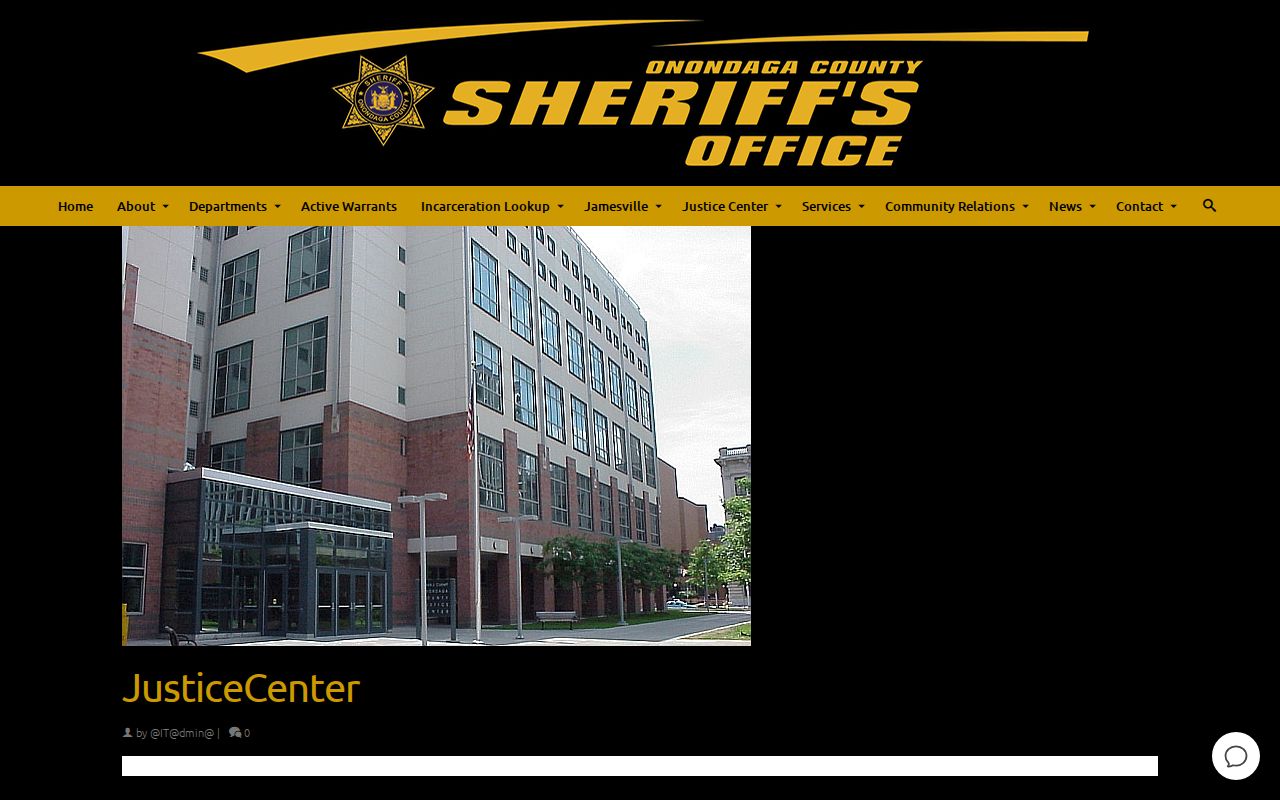
Custody and registry tools are narrow public-safety sources, not neighborhood directories. For current county custody, the Onondaga Sheriff’s Justice Center page links an incarceration lookup and identifies the Justice Center. The research did not locate a stable public endpoint or a result-field screen. Confirm a supported full name, date of birth, facility, and current booking status directly with the Sheriff before treating any result as current.
The Justice Center page is the source for the county custody route.
For state custody, the NYS DOCCS lookup uses a complete name and date of birth when a DIN is unknown. It is a state-facility and supervision tool, not a county-detention list. A clearly federal question belongs with the Federal Bureau of Prisons locator, which covers federal inmates from 1982 forward and has its own search form.
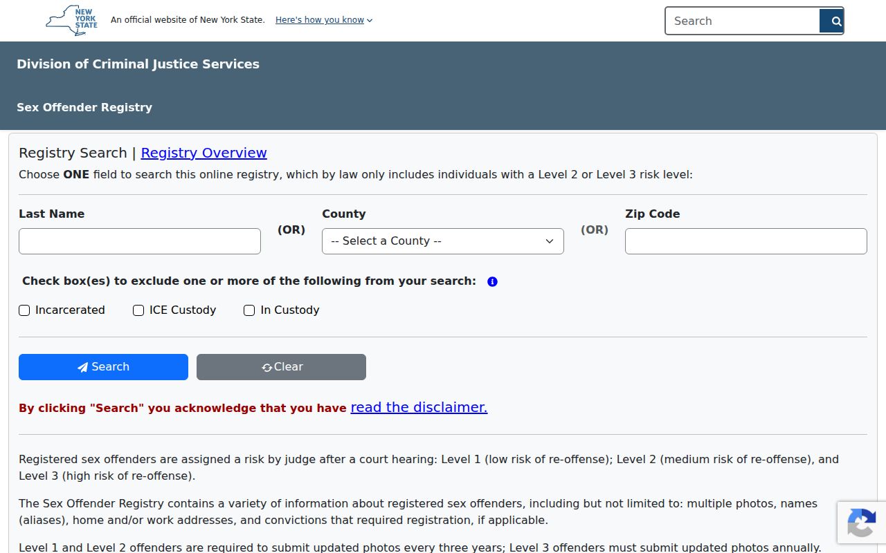
The New York DCJS registry provides an online directory for public Level 2 and Level 3 records. Its search form uses one primary criterion at a time, last name, county, or ZIP, plus CAPTCHA. The Level 1 or pending route is by telephone and requires a name plus an identifier. The registry warns that harassment, threats, and misuse can bring criminal penalties. A record must be checked for spelling, middle name, age, photograph, and county before it is attributed, and it must never be turned into a block warning list.
The official DCJS form displays the state-controlled registry search options.
For an immediate safety emergency, contact emergency services. Otherwise, use the responsible agency’s official route and avoid sharing or confronting people based on an unverified or old result.
Camillus Neighbors Through Time
Historical work adds a different layer to a Camillus block. The 1874 town and village maps can preserve roads, hamlets, and lot context. The 1940 Sanborn item shows mapped structures, materials, uses, street numbering, and landmarks in the covered area. OCPL directories, census schedules, newspapers, and obituary material may add a name, household, post office, or occupation for a stated date. Each source has a coverage limit and should be labeled with its year.
The Town of Camillus includes the Village of Camillus, Fairmount, Warners, and Amboy-Belle Isle labels in its history. Nine Mile Creek, the Erie Canal corridor, railroad, and trolley routes can appear in maps, deeds, newspapers, and directory clues. They help reconcile a historic road or post office with a present parcel, but they do not replace a legal description. Use the map and an SBL together when an old street number does not line up cleanly.
Camillus Neighbor Record Survival
The Town’s 1829 fire destroyed its first 20 years of town records, so an early block cannot be reconstructed from a continuous municipal list. County Clerk land records begin in 1794 and can supply a landholder or legal-description lead before the fire. Census records, church and cemetery sources, maps, newspapers, and local family files fill different parts of the same historical picture.
That record gap is a local story with a practical result: preserve the date and source beside each finding. A name on a deed or in a directory is a lead for that document’s date. It does not prove that the same person occupied every nearby parcel or remained there later.
Camillus Neighbor Tool Comparison
Official records and commercial neighbor-search categories answer different questions. A public map, property portal, clerk index, or dated directory names the custodian and record date. Commercial tools may combine prior addresses, public filings, and other datasets into a geographic or name interface. That convenience can blur distinct households, preserve stale information, or remove the correction path that comes with an official record.
| Official record route | Commercial neighbor-tool category | Practical difference |
|---|---|---|
| GIS, RPTS, deed index, and library source | Compiled geographic or name interface | Official routes identify the record custodian, date, scope, and correction channel. |
| One selected parcel at a time | Broad household or address association | Parcel evidence should not be expanded into claims about everyone nearby. |
| Dated directory, map, or census source | Undated or mixed-source profile | Historical evidence can be tied to its published year instead of being presented as current. |
Use the official source first, record its date, and correct an error through the source custodian. A result from any category is a research lead until the underlying record and parcel connection are checked.
Camillus Neighbor Privacy Limits
What remains private on a block is as important as what a parcel map displays. Public records do not create a complete list of household members. Delivery and utility customer information, DMV-linked personal data, protected voter addresses, sealed court records, victim addresses, and records withheld under applicable exemptions are not material for a neighbor lookup. The Address Confidentiality Program uses a substitute address for qualifying participants, and a protected address must not be reverse engineered.
Keep current property evidence, historical research, and safety information in separate notes. Do not publish a living person’s date of birth, phone number, email, sensitive location, or a speculative household connection. If a record appears wrong, request correction from the office that maintains it rather than copying it across sources.
Lawful use. Camillus neighbor research can support block history, civic curiosity, and careful property questions. Do not use public records to stalk, harass, threaten, surveil, or harm another person.